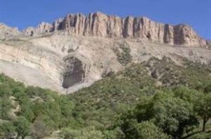
Kabirkuh is a continuous mount a part of Zagros Mount. It extended from Abaftab Kenjan Cham River to Karkhe River of Alvar Garmsiri Village of Khoramabad County of Lorestan, in the southeast. It extended to Seymareh, Karkhe, in its north and northeast side, and to Iran and Iraq borders in the southern part.
Kenjan cham Valley length to Karkheh River is 175 kilometer and its width in the distance between Seymareh or Karkhe River and Iran and Iraq borders is 45 -80 kilometer. Its area is about 9500 square kilometers.
This mount has lots of heights which their height decrease in west and southwest part. Its highest mount is in its eastern part and called Kabirkuh. Kabirkub is located 18 km far from east of Akovaz and is 2790 meter high. Lots of rivers originated from this mount which pours in Iraq fields, some of them join to Seymareh and Karkhe River.
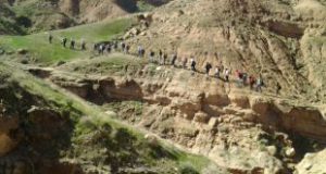
To reach this place, you can go to Ilam- Darreh Shahr Road, BahramKhani Village, Kulam Bala, Guran Village, Pineh Mountain Pass, Mazbur Drainage divide orderly.
- Please feel free to call us on 00989020038045 (Phone, Whatsapp, Telegram) or contact by info@mustseeiran.com, if you require any further information.
Follow us on Instagram @mustseeiran.com_insta