Ilam City

Ilam City

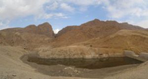
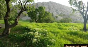
Ilam was called Orivjan once, it was built in a district named Hossein Abad and was named Ilam one year later by Academy of Persian Language and Literature. It had mountainous and pleasant weather.
Vlian Empire was in Ilam and Poshtkuh from the past three centuries. The most famous commanders of Vlian was Hossein Khan, Qolam Reza Khan, and Hossein Qoli Khan Abuqadareh. The dynasty depends on Iran government and pay tax and give soldiers to the government each year. By this deed, they got the position of commander of a district and governed the Nomad of their district.
Their government center was not fixed so Kishlak of Nomad was in Iraq Baqshahi or Beinonahrein Mosque and in summers in Holeylan or Hossein Abad (Central Ilam). 1500 camps were lived in Valy City which all belonged to Poshtkuh soldiers. Their costs were gained by taxes paid by people.

The last commander of the district was downed by Reza Shah and refuged to Iraq. After that Hossein Abad was changed to Ilam.
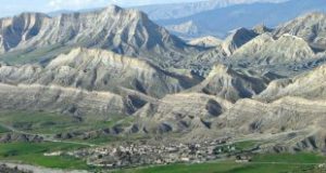
Nowadays Ilam is considered the political-official center of the province a developed province in the west of the country.

  • Please feel free to call us on 00989020038045 (Phone, Whatsapp, Telegram) or contact by info@mustseeiran.com, if you require any further information.
    Follow us on Instagram @mustseeiran.com_insta

Dehloran County

Dehloran County

This city is located in south and southwest of Dinarkuh Hill and was known as Dehloran from ancient time.
The ancient and old things have been found there indicate that the antiquity of this district relates to prehistory especially the Sasanian Empire. Remains of historical cities and hills indicate the county old history.
Dehloran geographical position makes it an important city. Its position also causes lots of damage through history. Its importance is kept through further eras. The city destroyed a lot through the Iran Iraq War. The city was renovated after the war and was considered as an important tourist city.
Besides its tourist attraction has grand petroleum resources and agricultural fields which doubled its economic and geographical importance.

  • Please feel free to call us on 00989020038045 (Phone, Whatsapp, Telegram) or contact by info@mustseeiran.com, if you require any further information.
    Follow us on Instagram @mustseeiran.com_insta

Abdanan County

Abdanan County

This county is located on the south hill of Kabir Kuh. This county has lots of mineral resources like petroleum, sulfur, jungles, agricultural and animal husbandry pastures. Its monuments all around the county declare its oldness and civilization. Gurgabran and Krodit Castle are some of its antique monuments. The county has lots of promenades.

  • Please feel free to call us on 00989020038045 (Phone, Whatsapp, Telegram) or contact by info@mustseeiran.com, if you require any further information.
    Follow us on Instagram @mustseeiran.com_insta


Ab Aftab of Ilam

This river originated from Manasht, Qelarang, and Chamangir Mounts of Kabir Kuh Mount which is located 20 kilometers far from southeast of Ilam. After passing Mishkhas Village in the south of Ilam joins Kenjan Cham River. The river length is 45 kilometer, its height is 2200 meter, and its slope is 8/2percent.

  • Please feel free to call us on 00989020038045 (Phone, Whatsapp, Telegram) or contact by info@mustseeiran.com, if you require any further information.
    Follow us on Instagram @mustseeiran.com_insta

Pir Mohammad River of Mehran

Pir Mohammad River of Mehran

Pir Mohammad River which is also called Galan Pir Mohammad is made from Kal Kala and Palashk Ab 41 kilometer far from northeast of Mehran. It passes Zamieh Mounts in west and Balijan in the east, and make a high waterfall. Then join Gazah River in Pir Mohammad Village and called Rudgari. The river is 6 kilometers long and its source is 1000 meter and its slope is 2/5 percent.

  • Please feel free to call us on 00989020038045 (Phone, Whatsapp, Telegram) or contact by info@mustseeiran.com, if you require any further information.
    Follow us on Instagram @mustseeiran.com_insta

Nasirian River of Dehloran

This river originated from Anaran Mount, 42 kilometers far from northwest of Dehloran. After passing a valley between Barak Koruyab and Barikab, 49 kilometers far from northwest of Dehloran enters Iraq Country. This river is 25 kilometers long before enters Iraq borders and height of its source is 1100 meter.

  • Please feel free to call us on 00989020038045 (Phone, Whatsapp, Telegram) or contact by info@mustseeiran.com, if you require any further information.
    Follow us on Instagram @mustseeiran.com_insta

Ab Ragzah River of Mehran

This river originated from Gohpariab Spring in the northeast of Mehran and passes from Balijan Mount in south valley and join Gavi River in Pir Mohammad Village. This river is 15 kilometers long and its source is 1350 meter high.

  • Please feel free to call us on 00989020038045 (Phone, Whatsapp, Telegram) or contact by info@mustseeiran.com, if you require any further information.
    Follow us on Instagram @mustseeiran.com_insta

Palashkab River of Mehran

This river is one of the Bivardeh Mounts. It is located 51 kilometers far from northeast of Mehran. It joins Vareh Spring, and in the southwest of Arkovaz,41 kilometers far from east of Mehran joins Kalkala River and make Pir Mohammad River. This river is 10 kilometers long and 1500 meter high.

  • Please feel free to call us on 00989020038045 (Phone, Whatsapp, Telegram) or contact by info@mustseeiran.com, if you require any further information.
    Follow us on Instagram @mustseeiran.com_insta

Rivers of Ilam

Surk, Shiravan, Kazab, Kalal, Hezar Khani, Gilal Kurgah, Gilal Chiqachalam, and… Rivers are in Ilam.
Ay Takhtan Ab Chalat, Ab sivel, Ab Fath, Hazuzan Fossil, Guran, Doirij, Mal Hafanri, Mimeh Varazan, and… Rivers are in Dehloran County.
Hab Ab Timeh, Ab Mazavard, Ab Konat, Tashmort, Talkhab, Tang Khashul, Siah Ab, Kal Kala, Godar Khosh, and… Rivers are in Mehran County.

  • Please feel free to call us on 00989020038045 (Phone, Whatsapp, Telegram) or contact by info@mustseeiran.com, if you require any further information.
    Follow us on Instagram @mustseeiran.com_insta

Chamava waterfall of Ilam


Chamava waterfall of Ilam

It is located 18 km far from Ilam-Salehabad and between Chamo and Marbareh. This spring originated from Ilam Mount and pour in Gedarkhosh River.

  • Please feel free to call us on 00989020038045 (Phone, Whatsapp, Telegram) or contact by info@mustseeiran.com, if you require any further information.
    Follow us on Instagram @mustseeiran.com_insta